Monitoring SAV Abundance, Diversity, and Health in Chesapeake Bay
Submerged aquatic vegetation (SAV) in Chesapeake Bay, also known as Bay grasses or underwater grasses, are one of the Bay’s most important resources. These underwater grass meadows and fringing beds that grow in the shallow waters along our shorelines provide numerous benefits to the people of the Chesapeake Bay watershed and the animals that live in the Bay itself. Because of their importance, SAV beds in Chesapeake Bay are monitored extensively as part of an integrated, three-tiered, hierarchical effort that serves as a model for SAV programs around the world.
Tier I: Chesapeake Bay-wide Aerial Survey
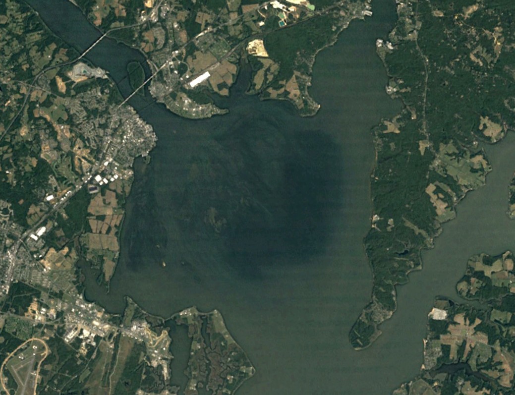 Aerial imagery depicting the wide expanse of thousands of acres of SAV in the Susquehanna Flats located nearby Havre de Grace, MD.
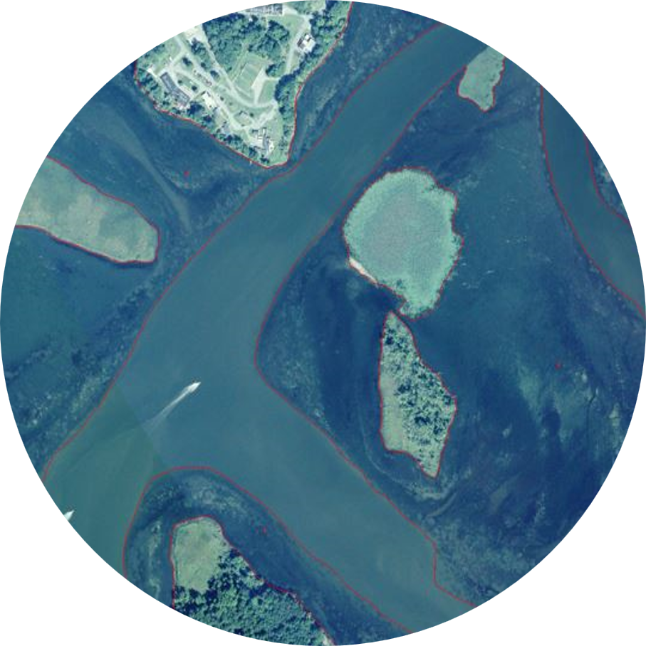 Aerial imagery depicting SAV bed boundaries in Chesapeake Bay.
 Thanks to the Virginia Institute of Marine Science (VIMS) and the Chesapeake Bay Program partner agencies that have supported the work, Bay scientists and managers have been able to track the abundance and distribution of underwater grasses throughout the Bay and its tributaries annually since 1984. The tier 1, Bay-wide aerial survey maps SAV by interpreting data collected remotely from planes and satellites. This broad-scale monitoring effort is complemented by on-the-water surveys conducted by partners and Chesapeake Bay SAV Watcher volunteers.
For more information about SAV distribution in Chesapeake Bay, refer to the
Interactive Map created by VIMS.
The Chesapeake Bay SAV Watchers program is part of the second tier of SAV monitoring in Chesapeake Bay. The program was developed by the Chesapeake Bay Program and is coordinated by the Bay Program’s SAV Workgroup and the Maryland Department of Natural Resources.
As part of this effort, DNR scientists provide SAV Watchers training events and certify SAV Watchers Trainers, who then work with their volunteers to collect information about SAV throughout the Bay. Volunteers venture onto Bay waters by kayak or small boats to make observations about Bay grasses and learn about Bay health and SAV stewardship while collecting valuable data for Bay scientists and resource managers. This data is used to ground-truth Tier 1 SAV maps, make informed restoration decisions, and communicate Bay trends to the public.
For more information about the Chesapeake Bay SAV Watchers program, visit the website:
www.chesapeakebaysavwatchers.com.
Tier III SAV Sentinel Site
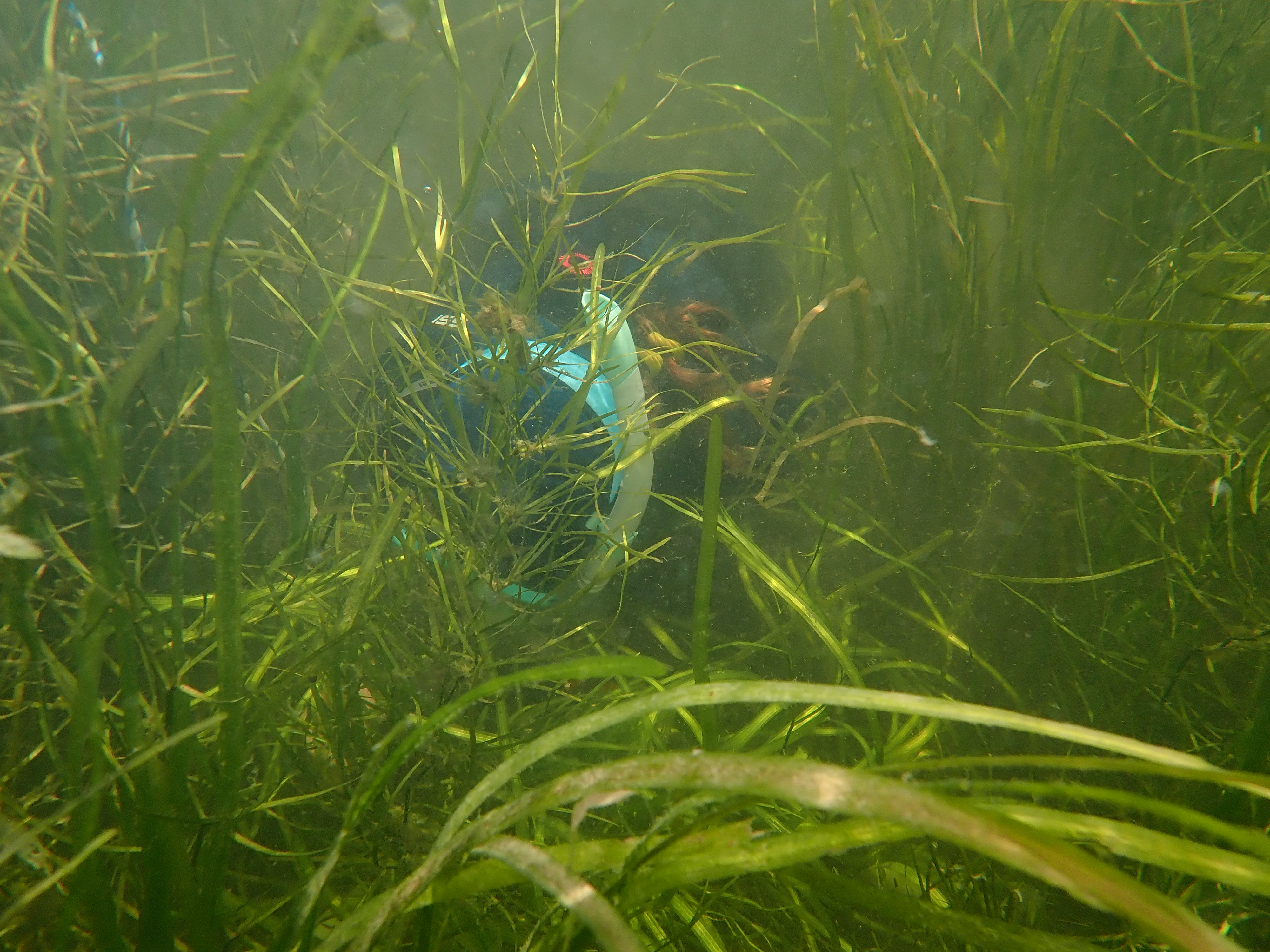 Up close and underwater, a Natural Resource Biologist uses free-diving gear and a quadrat to document SAV species composition, percent cover, and canopy height.
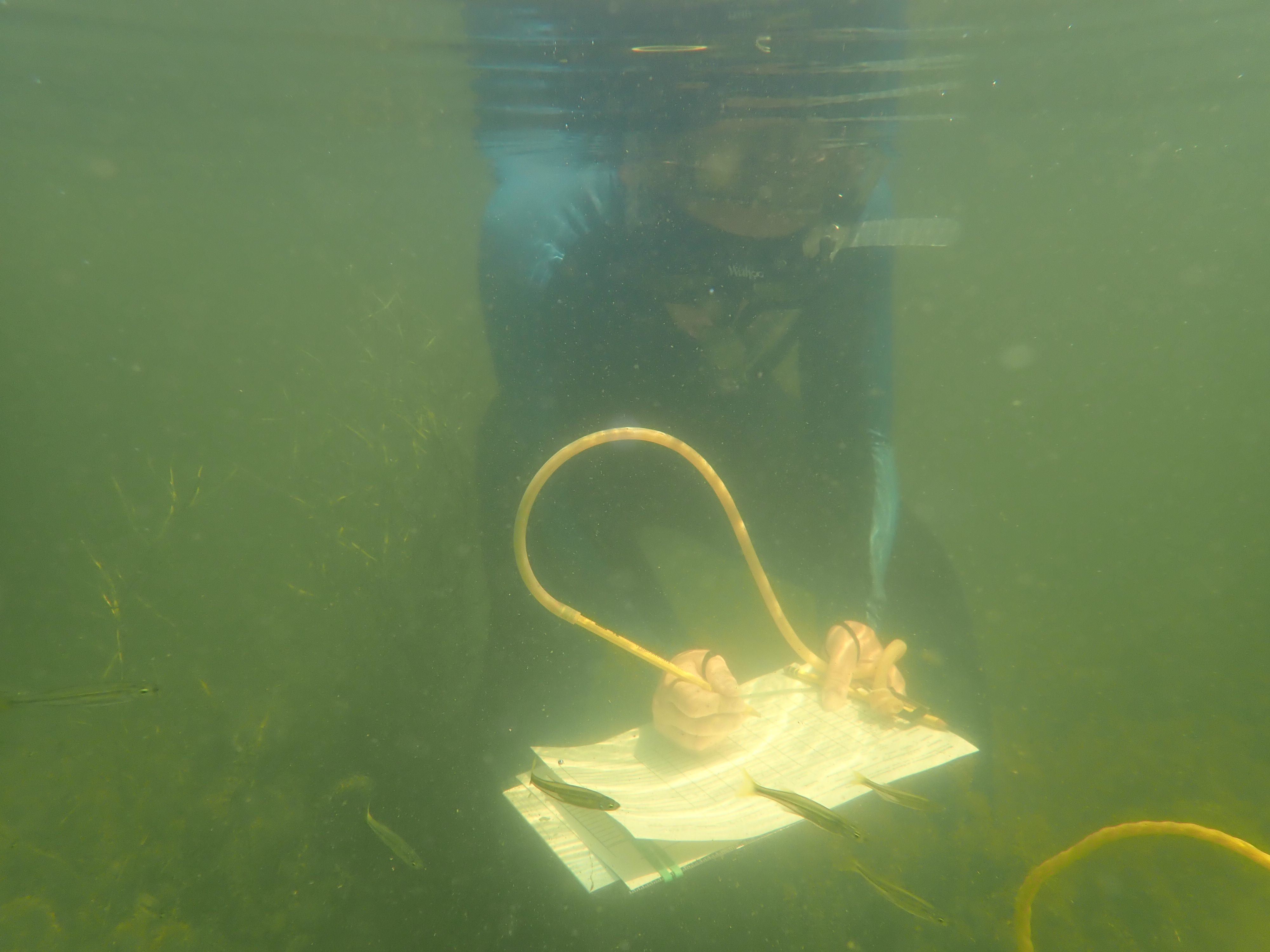 While surrounded by fish, a biologist records field observations underwater from within an SAV bed using a waterproof datasheet and clipboard.
 DNR’s SAV Program staff, along with partners from organizations and agencies around the Bay, are devoted to getting to the root of what influences SAV bed health! As the third tier of SAV monitoring in the Bay, the Chesapeake Bay SAV Sentinel Site Program takes Bay SAV scientists into the water for an up-close, fish-eye view of the grasses.
SAV Sentinel Sites provide a more detailed look into the factors affecting SAV growth and resilience in the Bay. Sentinel sites are located throughout each of the Bay’s four salinity zones: the tidal fresh, oligohaline (slightly salty), mesohaline (moderately salty), and polyhaline (salty). Sentinel sites are monitored using a standardized, detailed data collection protocol in which scientists investigate changes in SAV habitat characteristics and key indicators of ecosystem health to make informed management decisions.
For more information about the Chesapeake Bay SAV Sentinel Site program, visit
https://www.chesapeakebay.net/what/programs/monitoring/sav-monitoring-program/tier-iii-sav-sentinel-site-program.
Do you have questions about SAV in Chesapeake Bay? Contact Brooke Landry at
[email protected] for more information.
