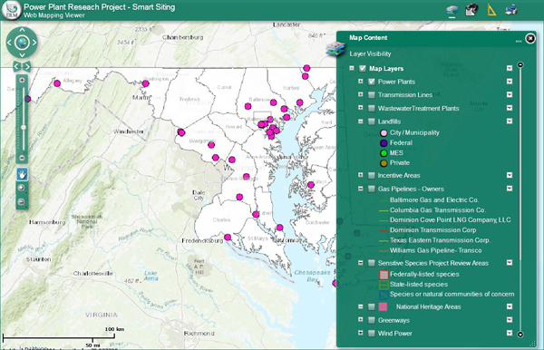
 In anticipation of the energy industry deregulation, the Maryland Power Plant Research Program (PPRP) initiated the Smart Siting Project in 1996. As the energy industry is deregulated, new generating facilities are expected to be more dispersed throughout the state. Also, more power plants may be constructed by out-of-state developers. To provide information to out-of-state developers, as well as to site these plants in an environmentally responsible manner, the Smart Siting geographic information system (GIS) siting tool was developed. The GIS siting tool uses various siting factors to identify regions of the state that are more favorable for power plant development.
More information can be viewed through the Smart Siting Online Mapping Tool.
Note that the Power Plant Research Program Smart Siting Project is designed to highlight potential areas for development, not specific sites that are suitable or unsuitable for facility development.
