A Screening Tool for Renewable Energy Projects
SmartDG+ is a free, online, interactive map-based screening tool sponsored by Maryland Power Plant Research Program (PPRP), a division of Department of Natural Resources (DNR), with support from
Maryland Energy Administration (MEA) and
Maryland Department of Commerce (MDOC) . It is intended to help developers and officials identify promising areas for the location of new wind and solar projects in Maryland. The tool focuses on screening factors of relevance to large-scale projects (i.e. greater than 2 MW.)
In order to create SmartDG+, PPRP evaluated electrical lines throughout Maryland, gathered publicly available data on barriers to project construction, and met with county and utility officials to discuss local priorities and policies of relevance. Combining this information is intended to help everyone save time and make better decisions about where to focus further research.
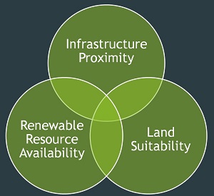 Infrastructure Proximity:
Renewable Resource Availability:
- Viable wind speeds (wind only)
Land Suitability:
- Protected areas
- Flood zones
- Land cover/land use
- Airports
- DOD no-go zones
- County zoning
The linchpin of SmartDG+ is a statewide map of 1-to-4 mile-wide corridors surrounding electrical distribution and transmission lines that appear strong enough to absorb large-scale projects. Within these corridors, the tool shows areas that remain promising after various standard screens involving resource availability, land use, protected areas, and more have been applied. The screening results are shown as technology-specific data layers: Possible Areas for SOLAR; and Possible Areas for WIND.
Viewers can choose additional screens such as:
- County-level zoning (learn more)
- County-level protected areas
- NAS Patuxent River Protected Areas
- MALPF easements
- Forested lands
To further support the siting process, SmartDG+ provides points of contact for the military and other protected lands, along with environmental and cultural resource areas. It is important to mention that the military installations and operational areas are not necessarily unsuitable for siting and users are encouraged to reach out to the contact listed. Learn more about military operations and siting for renewable energy projects by visiting
HERE or review the
Maryland Military Assets and Considerations for Renewable Energy Development Report.
PPRP reaches out annually to county officials to confirm that all zoning information in the tool is accurate and up-to-date. However, information included in SmartDG+ should not be relied upon without further verification as county information is constantly evolving. PPRP strongly recommends that anyone interested in siting a large-scale renewable energy system or facility at a specific site should contact the county or municipality where it is located. The local jurisdiction's planning or zoning department is the appropriate entity to confirm the accuracy of the zoning information and can respond to other relevant questions regarding the site.
As previously mentioned, the information within SmartDG+ is meant to serve as an initial screening tool for developers. Additional research will be necessary before development can proceed. For an example, utilities must always be consulted to determine whether a specific project can safely and economically connect to the grid.