Understanding Climate Impacts in Maryland
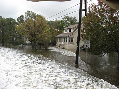
Like virtually every part of our globe, Maryland is vulnerable to the effects of climate change. Citizens across our state are currently experiencing more dangerous heat days, intense storm events, and sunny day coastal flooding at frequencies higher than in previous decades. The frequency and intensity of these events is expected to continue to increase over time, making it imperative that Maryland take action to mitigate greenhouse gas emissions and to make our state more resilient. Ecological restoration practices such as tree planting and wetland creation are an important tool that can help accomplish both of these goals.
More information about Watershed
and Climate Services Restoration Activities
The Maryland Restoration and Resilience Map
To enhance the state’s ability to prepare for and respond to the effects of climate change, Maryland Department of Natural Resources, in partnership with the Chesapeake Conservancy Conservation Innovation Center and funded by the National Oceanic and Atmospheric Administration (NOAA) has developed the
Maryland Restoration and Resilience Map.
Maryland Restoration and Resilience Map
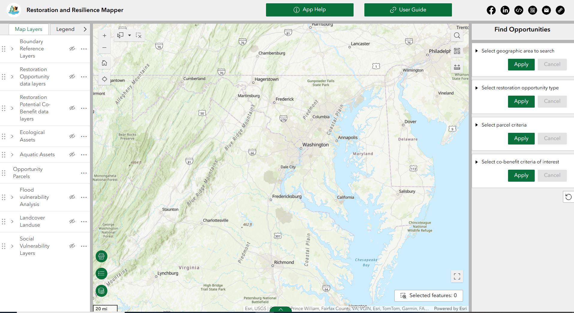
The purpose of this map is to support restoration and climate resilience activities in Maryland. The tool contains a collection of environmental, hydrological, and social datasets to support landscape and parcel assessment activities. The Maryland Restoration and Resilience Map provides planners, practitioners, and citizens with the the ability to:
- identify areas in the state that are vulnerable to climate change
- identify potential restoration opportunities in those areas
- understand how restoration practices can provide many other ecosystem service benefits like improving our water quality, air quality, and providing wildlife habitat
Restoration and Resilience Geospatial Data
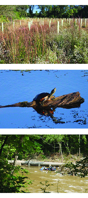
Restoration Opportunities Layers
- Tree Planting Opportunities
- Riparian Planting Opportunities
- Coastal Wetland Restoration
- Inland Wetland Restoration
Potential Restoration Co-Benefits Layers
- Carbon Sequestration Potential Amount
- Carbon Sequestration Potential Score
- Air Pollution Removal Potential Score
- Wildlife Habitat Potential Score
- Watershed Level Scores
- Percent Forest
- Percent Impervious
- Percent Forest Change
Flood Vulnerability and Risk
- Coastal Flood Risk
- Populated Areas
- Socially Vulnerable Populated Areas
- Riverine Flood Risk
- Populated Areas
- Socially Vulnerable Populated Areas
|
|
|---|
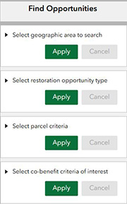 |
"Find Opportunities” Tool
A key feature of the Maryland Restoration and Resilience Map is the
“Find Opportunities” tool. This tool is intended to support restoration and climate resilience activities in Maryland by allowing users to identify parcels in a specified geographic area of interest (county, watershed, etc), based on user defined restoration opportunity type, co-benefit type, and associated criteria.
|
