Trail Information
Sang Run Trail Map
Sang Run State Park offers trails for everyone with varying lengths and difficulties. All the trails are great for hiking. Additionally, the trails allow snowshoeing and cross-country skiing in winter.
Pick up a trail map in the Friends Store or at the bulletin board at the parking lot.
-
Bluebird Trail (1.4 mile)
The blue-blazed trail traverses the agricultural farm fields and passes by a private family cemetery. A diverse grouping of habitats along the meadow edge and wooded area offers habitat for many species of mammals, birds, and butterflies. -
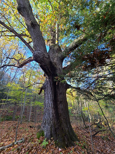
Champion Tree Trail (0.1 mile)
The green-blazed trail leads to the Champion Black and White Oak trees and Black Locust. Trail starts across from Friends Store. -
Hawthorn Hideaway Trail
(1.2 mile out and back)
The red-blazed trail follows a old farm road northward through fields with hawthorn and apple trees. The trail loops around a pollinator meadow. Notice how the landscape changes and you will periodically see vernal pools creating habitat for a variety of amphibians along the trail.
-
Grosbeak Grove Trail (0.2 mile)
The orange-blazed trail passes through a mixed hardwood forest along the edge of the main meadow at Sang Run. This wooded area is a successional habitat and demonstrates different stages of a forest. The woods provide habitat for a variety of animals, such as wild turkey and white- tail deer and variety of birds. This trail is an alternative to the bluebird trail.
