Patapsco Valley State Park
Main_Content
McKeldin Area Trails
A new map of the trails at Patapsco Valley State Park's McKeldin area can be downloaded for free from this website. Please make sure to read the printing instructions and information for how to download the file to cell phones. The map is in a PDF format that requires Adobe Reader. To get the free Adobe Reader go to Adobe.com.
Trail use can be a wonderful way to enjoy this area.
 Rapids Trail (.7 mile) - This trail begins at the southern end of the park, or it can be accessed from the Switchback Trail. The trail's name hints at its destination, one of the park's best-kept secrets, a cascading rapid on the Patapsco River that flows into a large, deep pool of water. This is a great fishing spot for anglers of all ages. Swimming is not permitted due to dangerous undercurrents. The exposed rocks in this area of the river are a favored sunning spot for several species of snakes, including the northern water snake and an occasional copperhead, one of only two venomous species in Maryland. As a part of our natural world, snakes should be left unharmed. They effectively control populations of small mammals, like mice and rats, as well as provide an important food source for hawks and other predators. The Nongame and Endangered Species Conservation Act protects all native snakes in Maryland.
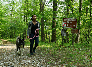
- Switchback Trail (4 miles) – This trail begins by the contact station at the top of the hill near the entrance to the park. Hikers of all ages, mountain bikers and equestrians will enjoy this beautiful riverside trail. The northern part of this trail is foot-use-only, but riders can continue their loop by using the Plantation Trail. During late fall and winter, enjoy a scenic view at the Liberty Dam Overlook located at the end of the trail.
- Plantation Trail (1.4 miles) - This trail, which begins at the basketball courts and horse trailer parking area, is one of the favored equestrian routes. The trail is steep and passes through a series of pine groves, running along one of the highest ridges in the McKeldin Area.
- Tall Poplar Trail (1.4 miles) - This trail can be accessed from Shelter #576 or across the road from the basketball courts. Aptly named for the impressive tulip poplar trees that are found along the way, you will have an opportunity to hike or ride the wide variety of terrain that McKeldin has to offer. The trail traverses moderately steep slopes, connecting riverside habitats to hardwood forests and open fields.
- Medicine Tree Trail (.3 mile) - This trail begins at the youth group camping field parking lot. A short loop, the trail is quite rocky and includes a bridge over a deep ravine
- Spring Glen Trail (.7 mile) - This loop trail begins across the lane from the contact station located at the entrance to the park, and will give you an opportunity to check out the McKeldin Area right from the start.
Tips for trail users:
- Wear appropriate foot wear
- Know your route and be prepared for emergencies
- Carry water and a snack
- First aid kit and safety equipment reccommended
- Dress for the weather
- Let someone know your itinerary and route – cell phones are not reliable in the valley
- Help us sustain our trails. Avoid trail use in wet conditions. We recommend you wait at least 24 hours after a rain event before venturing out along the trails again.