The Office of Outdoor Recreation has partnered with Maryland’s Best for a second year to churn up a delicious challenge for families – hiking the
Maryland Ice Cream Trail!
Now in its 13th year, the state’s official Ice Cream Trail features 14 dairies that produce and serve farm-fresh ice cream. To encourage visitors to extend their trip and get outside, the Maryland Department of Natural Resources has identified recommended trails near each creamery. Visitors can win prizes by checking in at the various locations, with the chance to win a grand prize if they hit all of them.
How to Participate
Maryland’s Best is excited to announce a streamlined digital check-in experience! Consumers can download the
Let’s Rallie app on Apple or Android phones for free to see all locations available on the trail, each featuring a unique QR code to scan to check in when you visit.
CLICK HERE TO GET STARTED AND DOWNLOAD THE APP!
Prizes
Check in using the
Let’s Rallie app at each location and be eligible to win a sweet treat! Winners must be Maryland residents who are 18 or older. Download the app now and win if you are:
- The first app check-in
- The first person to check in at 5 dairy locations
- The first person to check in at a creamery and the matching hike location
- The first person to check in at 7 hiking locations
- The first person to tag @mdsbest and the creamery on Instagram (remember, you have to be following our account for us to see it)
- The first person to tag @marylanddnr and the park at which you hiked on Instagram (remember, you have to be following our account for us to see it)
Grand Prize
Do you have what it takes to be Maryland’s Best Ice Cream Trailblazer Champion?! Check in at every location on the trail, and you will be eligible to win the grand prize! Each person who completes the trail by
September 1 will be entered to win a $50 gift card to a creamery of their choice. The winner will also receive a copy of the children’s book “Tales of the Dairy Godmother: Chuck’s Ice Cream Wish,” and the 2025 Maryland’s Best Ice Cream Champion Trailblazer trophy. Additionally, anyone who checks in at all the hiking trails on the Let’s Rallie app by September 1 will be eligible to win a state park pass, good for one year!
Don’t want the app or can’t download the app? You can take photos at each location and email them to
[email protected] by September 2. Please send all your photos at once!
Use
AllTrails to navigate your hike and easily share your adventure on social! AllTrails helps people discover and navigate trails in their neighborhoods and around the world while staying prepared, informed, and ready for the trails.
**To be eligible for the grand prize, you must check in at each trailhead on the Let’s Rallie App or include all your photos in one email to
[email protected] .
Maryland Ice Cream Trail Stops (by region):
An interactive map of creameries and trails can be found at
https://marylandsbest.maryland.gov/24239-2/
Central
-
Creamery:
Broom’s Bloom Dairy
Trail: Palmer State Park,
Iron Works Trail (Yellow Blazes), 2.7-mile loop, moderate
From the parking lot, start on the Hornbeam Trail (white blazes). This trail loops partly through the open fields and into the forest. Follow the Hornbeam until you reach the intersection with the Iron Works trail (yellow blazes). If you want to see a tributary to Deer Creek and add some length to your hike (total will be 3.7 miles), take the Iron Works Trail to the Flint Mill Trail (red blazes).
Notes: There is no restroom available. Dogs are welcome on a leash.
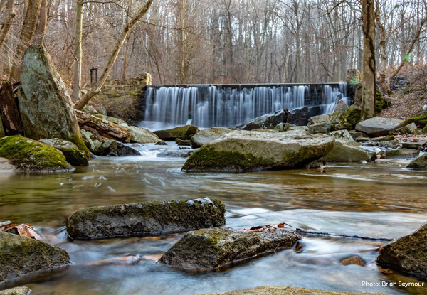
 Gunpowder Falls State Park
-
Creamery:
Prigel Family Creamery
Trail: Gunpowder Falls State Park (Pleasantville Area),
Ma & Pa to Pleasantville Loop Trail, 4.7-mile loop, moderate
The Ma & Pa Trail follows the former route of the MD & PA Railroad, where it ran along the Little Gunpowder. It is found uphill & upstream of the Bottom Rd parking area. More adventurous visitors can make it a 4.7-mile loop by crossing the river at Pleasantville Road and returning downstream on the opposite bank.
Notes: Parking is limited (especially on weekends), no restrooms, dogs on leashes permitted, limited cell service (we recommend downloading the AllTrails map ahead of time).
-
Creamery:
Keyes Creamery
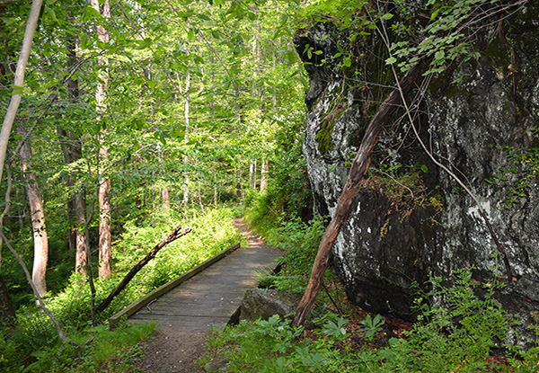
Trail: Trail: Susquehanna State Park,
Rock Run and Land Of Promise Trail Loop, 1.7-mile loop, easy
The river area of Susquehanna State Park is one of the cradles of the Industrial Revolution in MD. The Rock Run/Land of Promise Loop takes visitors past key features while also highlighting the natural beauty of the stream and bluffs. This 1.7-mile loop trail is generally considered an easy route, it takes an average of 46 minutes to complete. This is a popular trail for birding, hiking, and running, but you can still enjoy some solitude during quieter times of day.
Note: Dogs are welcome, but must be on a leash.
 Susquehanna State Park
Eastern
-
Creamery:
Chesapeake Bay Farms - Berlin OR
Chesapeake Bay Farms - Pocomoke
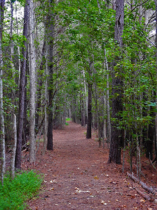
Trails: Assateague Island State Park,
Rackliffe House Trail Loop, 1.1-mile loop, easy
OR Pocomoke River State Park (Milburn Landing),
Pocomoke Ice Cream Bike Loop, 8-mile loop, easy (see hiking option also)
Assateague Island Rackliffe House Trail Loop: Located close to the Chesapeake Bay Farms location in Berlin, the easy 1.1-mile trail loop via historic Rackliffe House shows off what shore living may have been before the beach became the domain of summer vacations. The 18th-century manor house is surrounded by tidal wetlands and an emerging forest. Of course, after walking through history, you must cross the Verrazano Bridge and visit the ocean before having a cone.
Notes: Restrooms are located at the Visitor Center; leashed pets are permitted on the trail however, there are no trash receptacles on the trail, so please plan to clean up after and then dispose of your pet's waste at the Visitor Center.
OR
Pocomoke
Ice Cream Bike Loop: This is an 8-mile round-trip biking loop starting from the Milburn Landing Day Use Area. It leads to Chesapeake Bay Farms Creamery in Pocomoke about halfway through, then loops back to the park. The route is flat, low-traffic, and great for all biking levels.
If you don't have a bike and prefer a shorter hike, check out the
1.4-mile Bald Cypress Loop, which can be accessed from the same trailhead.
Notes: Ample parking is available at the Day Use Area, and there are restrooms on-site.
 Rackcliffe Trail
 Pocomoke River State Park
- Creamery:
Lockbriar Farms
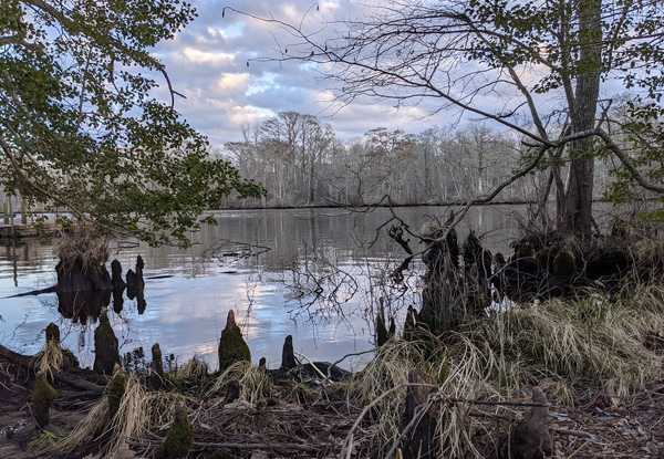
Trail: Sassafras Natural Resource Management Area,
Tidal Pond Loop, 3.9-mile loop, easy
Some say the best Bay view is the one found from the bluffs at the end of the Old Lodge Trail. As a double-bonus, you can add in the spur and descend to the Sassafras River to comb through sand and get your feet wet. If you're also a paddler, consider visiting in mid-summer with your canoe or kayak to row through the American Lotus, which bloom in the river close by the Turners Creek put-in.
Notes: There is a portable toilet at the main parking lot, and dogs are welcome on a leash.
Western
-
Creamery:
Deliteful Dairy
Trail: Fort Frederick State Park,
Beaver Pond Trail, 1.9-mile out-and-back, easy.
The signature feature of the park is its namesake fort. But if you drive past, you'll also find the C&O Canal, numerous ponds, and the Potomac River. The Beaver Pond trail starts by one of the ponds and extends into a field being transitioned to forest before returning to the trailhead via a route along the river.
-
Creamery:
Misty Meadow Farm Creamery
Trail: Cunningham Falls State Park (William Houck Area),
Lower Trail and Cliff Trail Loop, 1.2 miles, easy to moderate
There are two trails you can take to access the Falls from the lake - you can choose one of the trails as an out-and-back, or combine the trails to make a loop!
Lower Trail - ½ mile (red blaze) -- This easy-to-moderate trail is the shortest and easiest access to the Falls. Interpretive signs and benches along the way. Return to the lake by this trail or the
Cliff Trail. This trail terminates at the Falls. Cliff Trail - ¾ mile (yellow blaze) -- Rough terrain offers strenuous hiking past rock outcrops that lead to the falls. Return to the lake by this trail or the Lower Trail.
Notes: Dogs must remain leashed at all times. Cunningham Falls State Park often fills to capacity and turns vehicles away on weekends. Please plan accordingly and check with the park before you depart. Please visit the Maryland State Park's X Account or Google to determine the status of the park.
 Cunningham Falls State Park
-
Creamery:
Glamourview Creamery
Trail: Rivermist Park,
Monocacy River Trail, 3.3-mile out-and-back, easy .
This 3.3-mile out-and-back paved trail is a pleasant stroll along the Monoacy River. It offers excellent views of the river and good shade throughout. The trail features very slight hills, making it an enjoyable and scenic walk, run or ride.
Notes: The trail starts near the Riverside Park Boat Ramp, where nearby parking is available. With a slight detour off the paved trail, there are several points to access the water for hikers. This location is also part of the
Monocacy Scenic Water Trail.
-
Creamery:
Rocky Point Creamery
Trail: Monocacy Natural Resource Management Area,
Furnace Branch Trail, 2.6 miles out & back, easy.
This trail follows an old wagon road along Furnace Branch. The stream and the trail are named for the Johnson Iron Furnace, a pioneering ironworks that was located alongside the creek about 1/4 mile along the trail, just beyond a large plank deck bridge.
Notes: The trail has four stream crossings, so make sure to bring shoes that can get wet. In mid-summer, consider also visiting the
McKee-Beshers Wildlife Management Area to check out the sunflower fields!
-
Creamery:
South Mountain Creamery
Trail: Gambrill State Park,
Yellow Poplar Trail, 6.2-mile out-and-back back, moderate
OR Carroll Creek Linear Park Loop in Downtown Frederick, 1.8-mile loop, easy
Gambril
Yellow Poplar Trail: The longest of the Gambrill trails, this 6.2-mile trail is only moderately difficult. Visitors who have several hours can hike up the mountain and out into the far reaches of the park. Enjoy the view from North Frederick Overlook as you continue north along a moderately sloped ridgeline walk.
Notes: Dogs must remain leashed at all times. Please remember to take valuables with you and lock your vehicle.
OR
Carroll Creek Linear Park: For those wishing to take an urban hike, consider strolling along the Carroll Creek Linear Park. This 1.8-mile loop runs parallel to Carroll Creek in downtown Frederick. Generally considered an easy route, it takes an average of 32 minutes to complete. This is a very popular area for hiking, running, and walking, so you'll likely encounter other people while exploring.
Notes: Dogs are welcome, but must be on a leash.
If visitors are looking for a longer hike, the Carroll Creek trail is also part of Frederick City's Shared-Use Path network that connects to a much larger area, including Baker Park and points further west along the Golden Mile via the Rock Creek Trail through Waterford Park.
If visitors want a more leisurely pace, only about 3 blocks west of the creamery, also connected to the Carroll Creek trail, is the
Baker Park Tree Walk that highlights 28 unique and specimen trees.
-
Creamery:
Brown Cow Creamery
Trail: Patuxent River State Park,
Patuxent River Adventure Course, 5-mile loop, moderate
For full details, visit:
https://www.grit-adventures.com/adventurechallengecourse Gather your friends or family for an unforgettable adventure at Patuxent River State Park! This unique course is designed to challenge both your body and mind while highlighting the park’s distinctive features, created in collaboration with its dedicated staff and volunteers.
Begin your journey at the main parking lot, where you'll find a flyer located next to the kiosk with a QR code. If you complete all the challenges in a single hike, the total distance is approximately 5 miles. However, the course is designed to be enjoyed over multiple trips if completing it all at once isn’t an option. The terrain is slightly hilly, and the trails are well-maintained. This course is recommended for groups of 2-4 and ages 4 and up, but can be enjoyed by all ages!
Notes: If you don't want to participate in the challenges, this is still a great loop to go for a walk or hike. Dogs are welcome but must be on a leash.
-
Creamery:
Happy Cow Creamery
Trail: Soldier’s Delight Natural Environmental Area,
Choate Mine and Red Run Trail, 2-mile loop, easy
From the overlook parking lot go east, across Deer Park road, to the Choate Mine trail (red blaze). Go North (to your left) to the Choate Mine Trail head sign and hike until you reach an intersection make a left on Red run trail (orange blaze), follow the Orange blazed Red Run trail around until you come back to the Choate mine trail go North (right) and then immediate West (left) back towards the overlook parking area total length of trail is 2 miles.
Notes: This is a hiker-only trail. Please keep in mind that this is a sensitive area - please keep to the trail, as rare and endangered plants are living just off the trail. Keep dogs on a leash as there are a lot of ticks off the trail.
-
Creamery:
Moo Cow Creamery
Trail: Catoctin Creek Park,
Catoctin Creek Loop, 1.5-mile loop, easy.
This scenic 1.5-mile loop winds through forest, meadow, and along Catoctin Creek, with chances to spot woodpeckers, wildflowers, and historic landmarks. Highlights include creekside views and a vista overlooking Fox Haven Farm. The trail connects with the paved Vista Loops, red-blazed Heritage Grove Loop, and green-blazed Sensory Trail*.
Notes: There are 2 van-accessible parking spaces at the Sumantown Road lot. Most of the trail is gently graded, but some steep sections may require assistance or adaptive equipment. Benches and picnic areas are available along the way.
*The sensory trail is currently undergoing renovations, so access may be limited.
Southern
-
Creamery:
Miller Farms
Trail: Cedarville State Forest,
White Trail, 3.5-mile loop, easy
The White Trail is a popular 3.5-mile loop trail that passes through hardwood forest and pine plantations. It is a great trail for bird watching, hiking, and riding.
Notes: You will find the trailhead for the White Trail at the Charcoal kiln parking lot. Leashed pets are welcome. The trail is not stroller/ wheelchair accessible.

