Garrett, Allegany, Washington,
and Frederick counties
Western Maryland is characterized by its mountainous terrain, rolling hills, steep cliffs and large blocks of forested land. In this area of the state, paddlers can find slowly meandering creeks that are appropriate for fishing and floating, as well as Class V whitewater for more experienced paddling. Waterways in this part of the state are typically freshwater, rocky, and shallow and are significantly influenced by periods of drought and/or rain events. Deep Creek Lake, the Youghiogheny, Savage, North Branch Potomac and Upper Potomac rivers are among the major waterways that attract recreational boaters to the region.
Monocacy Scenic River Water Trail: The River with Many Bends
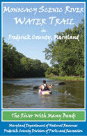 This water trails map provides detailed information for approximately 42 miles of water trail along the Monocacy Scenic River in Frederick County. The map is designed primarily for those touring by kayak and canoe, is printed on durable, waterproof paper, and provides details on all public water access sites starting at Rocky Ridge off of Maryland Rt. 77, on the upstream portion of the Monocacy River, to the confluence with the Potomac River at the southern end. This map includes information on a variety of natural, historic, and cultural attractions nearby and is a wonderful resource for people who wish to learn more about the variety of access and natural resources Frederick County has to offer.
The map was produced through a partnership between the Maryland Department of Natural Resources, the Frederick County Division of Parks and Recreation, the Tourism Council of Frederick County, the National Park Service Monocacy National Battlefield, and the Monocacy Scenic River Citizens Advisory Board.
This map is available from the
Frederick County Division of Parks and Recreation office at 355 Montevue Lane, Suite 100, Frederick, MD 21702 or visit. This map is currently sold out and unavailable from the DNR Outdoor Store.
Potomac River Water Trail: The North Branch
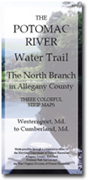 The Potomac River Water Trail: the North Branch details the northern reaches of the Potomac River in Allegany County, Maryland between Westernport and Cumberland. The area is depicted on three separate maps covering approximately 32 miles. This water trail was developed through a partnership between the Maryland Department of Natural Resources (DNR), the National Park Service (NPS), Allegany County and others. The maps show access points on both sides of the river including information on support facilities like restrooms, camping and fishing sites, and picnic and parking areas. The maps are printed on waterproof, tear-proof paper and are packaged in a zip closure plastic pouch. This map set is available through the
DNR Outdoor Store.
The Potomac River Water Trail: the North Branch details the northern reaches of the Potomac River in Allegany County, Maryland between Westernport and Cumberland. The area is depicted on three separate maps covering approximately 32 miles. This water trail was developed through a partnership between the Maryland Department of Natural Resources (DNR), the National Park Service (NPS), Allegany County and others. The maps show access points on both sides of the river including information on support facilities like restrooms, camping and fishing sites, and picnic and parking areas. The maps are printed on waterproof, tear-proof paper and are packaged in a zip closure plastic pouch. This map set is available through the
DNR Outdoor Store.
Potomac River Water Trail and the C&O Canal: Upper Potomac
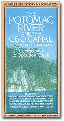
 This water trail guide details approximately 115 miles of the Upper Potomac River corridor and parallels the C&O Canal National Historic Park between Shepherdstown, WV and Cumberland, MD and picks up where the
Potomac River Water Trail: the North Branch map set leaves off. The five-map set shows access and support facilities along both sides of the river and is an invaluable resource for paddlers, boaters, anglers or outdoor enthusiasts interested in the area. The maps are printed on waterproof, tear-proof paper and are packaged in a zip closure plastic pouch. This map set is available through the
DNR Outdoor Store.
This water trail guide details approximately 115 miles of the Upper Potomac River corridor and parallels the C&O Canal National Historic Park between Shepherdstown, WV and Cumberland, MD and picks up where the
Potomac River Water Trail: the North Branch map set leaves off. The five-map set shows access and support facilities along both sides of the river and is an invaluable resource for paddlers, boaters, anglers or outdoor enthusiasts interested in the area. The maps are printed on waterproof, tear-proof paper and are packaged in a zip closure plastic pouch. This map set is available through the
DNR Outdoor Store.
Additional information on attractions and public access along this section of the C&O Canal can be found at the
National Park Service website.
Potomac River Water Trail and the C&O Canal: Middle Potomac
 Potomac River Water Trail and the C&O Canal: Middle Potomac This water trail spans approximately 100 miles of the Middle Potomac River corridor and parallels the C&O Canal National Historic Park between Sharpsburg, MD and Washington D.C. This map set picks up where the
Potomac River Water Trail and the C&O Canal: Upper Potomac map set leaves off. Maryland Department of Natural Resources is working in partnership with the C&O Canal National Historical Park and many other state and local agencies that have a presence along this section of the river in Virginia and Maryland, to create a new water trail map set for this portion of the river. This map set was created by the Interstate Commission on the Potomac River Basin (ICPRB) in the 1970s but is no longer available in hard copy. However, the ICPRB has redrawn and digitized the
maps so they can be downloaded and printed in a series on 8.5" x 11" paper.
Potomac River Water Trail and the C&O Canal: Middle Potomac This water trail spans approximately 100 miles of the Middle Potomac River corridor and parallels the C&O Canal National Historic Park between Sharpsburg, MD and Washington D.C. This map set picks up where the
Potomac River Water Trail and the C&O Canal: Upper Potomac map set leaves off. Maryland Department of Natural Resources is working in partnership with the C&O Canal National Historical Park and many other state and local agencies that have a presence along this section of the river in Virginia and Maryland, to create a new water trail map set for this portion of the river. This map set was created by the Interstate Commission on the Potomac River Basin (ICPRB) in the 1970s but is no longer available in hard copy. However, the ICPRB has redrawn and digitized the
maps so they can be downloaded and printed in a series on 8.5" x 11" paper.
Youghiogheny Wild and Scenic River
 In 1976 a 21-mile long segment of the Youghiogheny was designated as Maryland’s first Wild River. A state protected corridor along the river runs from Miller’s Run, just north of Oakland, to the Town of Friendsville. This corridor is managed by the Maryland Forest and Park Service.
There is no official map or guide to public access on the Youghiogheny River in Maryland, but public access points can be found at Swallow Falls State Park, in the Sang Run area off of Sang Run Road, and in Friendsville. The Hoyes Run area is a public access point for hiking, and fly fishing (catch and release only). Other points of access are primarily primitive and rugged so every effort should be taken by visitors to become familiar with the skills needed to safely enjoy the remote and primitive environment of the river.
While whitewater boating has become an increasingly popular way for many to experience the wildness of the Youghiogheny, the river is extremely difficult and potentially dangerous so be prepared. Information on whitewater boating may be obtained at the park office.
General park information can be obtained at 301-387-5563.
