Anne Arundel, Prince Georges, Calvert,
Charles and St. Mary’s counties
The region of Southern Maryland is a peninsula bordered by the Potomac River to the west and the Chesapeake Bay to the east. While predominantly rural, the landscape of the Southern region has areas with dense population and suburban development, particularly along the Route 301 corridor and closer to the Washington D.C. area. Steep cliffs can be found along the Chesapeake Bay shoreline and along areas of the Potomac River. Most of the streams, creeks and rivers experience tidal influences and have brackish water (a mix of fresh and salt water.) The Lower Potomac, Anacostia, Patuxent and Wicomico rivers are among the major waterways in the region, but hundreds of smaller streams, creeks and rivers abound providing numerous opportunities for recreational boating.
Calvert County Water Trails – NEW for 2018!
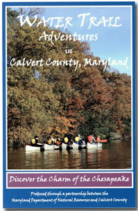 This guide was produced in 2018 by Maryland Department of Natural Resources in partnership with Calvert County, the Towns of North Beach and Chesapeake Beach, Calvert Nature Society and Jefferson Patterson Park and Museum. Maps and detailed descriptions of access sites and amenities are provided for six paddling routes along waterways in Calvert County including the Chesapeake Bay, Patuxent River and St. Leonard, Cocktown and Caney Creeks. The guide also provides information on historic, cultural and tourist resources in Calvert County. To get this publication visit the
DNR Outdoor Store or contact the Calvert County Natural Resources Division by calling 410-535-5327 or
visit their website.
This guide was produced in 2018 by Maryland Department of Natural Resources in partnership with Calvert County, the Towns of North Beach and Chesapeake Beach, Calvert Nature Society and Jefferson Patterson Park and Museum. Maps and detailed descriptions of access sites and amenities are provided for six paddling routes along waterways in Calvert County including the Chesapeake Bay, Patuxent River and St. Leonard, Cocktown and Caney Creeks. The guide also provides information on historic, cultural and tourist resources in Calvert County. To get this publication visit the
DNR Outdoor Store or contact the Calvert County Natural Resources Division by calling 410-535-5327 or
visit their website.
St. Mary’s County Water Trails
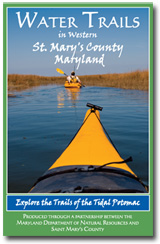 In partnership with St. Mary’s County, the Town of Leonardtown, and a committee of local paddling enthusiasts, Maryland Department of Natural Resources assisted in the development of a series of water trails along the western side of the St. Mary's peninsula. A water trails guide, published in July 2010, provides maps and detailed information on access sites and paddling routes along the Lower Potomac, Wicomico and St. Mary’s Rivers as well as McIntosh Run, Herring Creek, and Smith and Jutland creeks. The guide also features historic, cultural and tourist resources. This map is available through the
DNR Outdoor Store and at the St. Mary’s County Welcome Center at Charlotte Hall. View the water trail map and
learn more about water access in St. Mary's County or call 1-800-327-9023.
In partnership with St. Mary’s County, the Town of Leonardtown, and a committee of local paddling enthusiasts, Maryland Department of Natural Resources assisted in the development of a series of water trails along the western side of the St. Mary's peninsula. A water trails guide, published in July 2010, provides maps and detailed information on access sites and paddling routes along the Lower Potomac, Wicomico and St. Mary’s Rivers as well as McIntosh Run, Herring Creek, and Smith and Jutland creeks. The guide also features historic, cultural and tourist resources. This map is available through the
DNR Outdoor Store and at the St. Mary’s County Welcome Center at Charlotte Hall. View the water trail map and
learn more about water access in St. Mary's County or call 1-800-327-9023.
Point Lookout State Park Water Trails
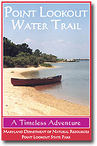 The Point Lookout water trails are located at Point Lookout State Park - the southernmost tip of St. Mary’s County where the Potomac River meets the Chesapeake Bay. The State Park offers a variety of paddling experiences that range from an hour or two to all-day excursions with overnight camping options. In addition to the water trail routes, the water trail map/guide also provides information on special features and points of interest on the Point Lookout peninsula. Originally printed in 2003 and reprinted in 2007, the guide features over 7 miles of water trails along three different routes in and around the Park. This map is printed on waterproof, tear-proof paper and is available through the
DNR Outdoor Store and at the Point Lookout State Park visitor center.
The Point Lookout water trails are located at Point Lookout State Park - the southernmost tip of St. Mary’s County where the Potomac River meets the Chesapeake Bay. The State Park offers a variety of paddling experiences that range from an hour or two to all-day excursions with overnight camping options. In addition to the water trail routes, the water trail map/guide also provides information on special features and points of interest on the Point Lookout peninsula. Originally printed in 2003 and reprinted in 2007, the guide features over 7 miles of water trails along three different routes in and around the Park. This map is printed on waterproof, tear-proof paper and is available through the
DNR Outdoor Store and at the Point Lookout State Park visitor center.
Charles County Water Trails
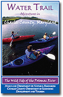 The Charles County Water Trails were developed though a partnership between Maryland Department of Natural Resources and Charles County. Originally produced in 2008, this map was updated and reprinted in 2014. It is designed for field use and is printed on durable, waterproof, tear-proof paper. This publication depicts four paddling routes in Charles County including trails along Mattawoman Creek, the lower Potomac River, Port Tobacco River and Nanjemoy Creek. Detailed information associated with each trail is provided including launch site and support facilities such as restrooms, picnic areas and parking areas.
View a PDF of the Charles County map.
Potomac River Water Trail: Lower Potomac
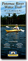 This water trail guide covers approximately 115 miles of the lower Potomac River from Washington DC to the Chesapeake Bay. The six-map set shows access and support facilities along the Maryland and Virginia shorelines and is a great resource for paddlers, boaters, anglers or outdoor enthusiasts interested in the Lower Potomac. These maps are printed regular paper and are packaged in a cardstock folder. They are not waterproof. This map is currently out of print. Download an electronic version of the Lower Potomac guide.
Anacostia Water Trail
 The Anacostia Water Trail map and guide was created in 2014 through a partnership between the National Park Service and the Anacostia Watershed Society. The guide has information on historic and cultural resources, access sites and other features associated with the Anacostia River. The trail covers a ten mile stretch of the River extending from Bladensburg, Maryland through Washington, DC to the Anacostia’s juncture with the Potomac River, about two miles south of Capitol Hill.
Download a copy of the map and guide and learn more about recreational opportunities on the Anacostia River.
The Anacostia Water Trail map and guide was created in 2014 through a partnership between the National Park Service and the Anacostia Watershed Society. The guide has information on historic and cultural resources, access sites and other features associated with the Anacostia River. The trail covers a ten mile stretch of the River extending from Bladensburg, Maryland through Washington, DC to the Anacostia’s juncture with the Potomac River, about two miles south of Capitol Hill.
Download a copy of the map and guide and learn more about recreational opportunities on the Anacostia River.
Patuxent River Water Trail
(Anne Arundel, Prince Georges, Calvert, Charles, and St. Mary’s counties)
The Patuxent River is approximately 110 miles long and is the largest river, completely within the state boundary of Maryland. The river corridor is rich in scenic beauty, wildlife, history. Many public parks and launching sites for recreational boating provide additional access for visitors to enjoy the river’s resources. The Maryland National Capital Park and Planning Commission (M-NCPPC) created a map of the upper section of the Patuxent River Water Trail between Montgomery and Howard counties.
The Patuxent River Commission in partnership with a host of other agencies and partners in Maryland has been working to create a larger, more comprehensive
map of the Patuxent River Water Trail.
