Parkers Creek, Calvert County
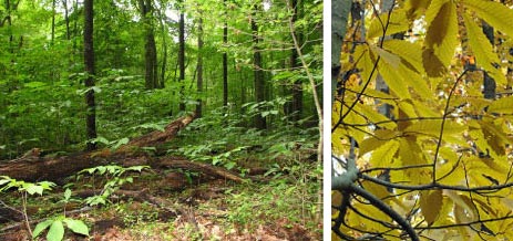
The extensive trails of Parkers Creek Natural Area invite visitors to enjoy one of the largest contiguous tracts of forest in Calvert County. From dry, sandy upland woods to cool, moist ravines and along forested wetlands, the trail system allows visitors to experience the unusual geology, topography and hydrology of this Natural Area. The ancient shell deposits from the Miocene Epoch that produce fossils on the beaches of Calvert County also create fertile soils in the inland ravines that support remarkable spring wildflower displays.

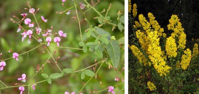
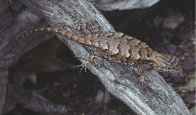
Flowers s uch as golden saxifrage and miterwort, uncommon on the typically poor soils of the Coastal Plain, thrive in the rich, moist soils of these steeply sloped valleys. Eastern fence lizards and other reptiles make their home in the dry, sandy uplands, as do some unusual plants, including the Endangered rigid tick-trefoil (Desmodium rigidum), a wildflower in the pea family. As with many legumes, the roots of the tick-trefoil (in combination with soil bacteria) are able to convert nitrogen from the air into a form that is useful for plants, allowing it to thrive in the low-nutrient soils. The extensive upland and wetland forests act as filters to maintain the high water quality of Parkers Creek.
Visitors can enjoy guided canoe trips that lead from the beach and ancient clay and sandstone cliffs on the Bay into the pristine marshes of Parkers Creek. Northern river otters and common muskrats are often seen along the creek. In summer, the tropical-looking flowers of swamp hibiscus and red cardinal-flower dot the marsh grasses with vibrant color. Moving upstream, paddlers leave civilization behind and experience the marsh as visitors have for hundreds of years. Parkers Creek Natural Area is owned by the American Chestnut Land Trust (ACLT) and the Maryland Department of Natural Resources. ACLT manages the property which encompass around 2,000 acres. The upland forests, wetland forests and marshes of the watershed support populations of nine uncommon and rare plant species such as the Threatened showy goldenrod (Solidago speciosa).
Interior is Superior
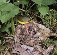
 The diversity and size of habitats within Parkers Creek make it a haven for nesting birds, particularly Forest Interior Dwelling Species (FIDS). The National Audubon Society recently designated Parkers Creek as an Important Bird Area due to the 19 species of FIDS found regularly breeding there. Of particular interest are the wood thrush and Kentucky warbler. These migratory songbirds have significant breeding populations here but are in decline throughout much of their breeding range in the U.S. Increased forest fragmentation has made their nests more vulnerable to parasitism by female brown-headed cowbirds. These unusual birds lay their eggs in other birds’ nests. For smaller songbirds, such as warblers and wrens, the adult ends up eventually feeding a chick that is nearly twice its size, while its own chicks starve!
The American Chestnut Land Trust

Much of the area within Parkers Creek is protected by the American Chestnut Land Trust. Founded in 1986, this grassroots land conservation organization is named after the former champion chestnut tree found within their first preserve. Unfortunately in 2006, the champion tree succumbed to the chestnut blight, a fungus accidentally introduced in the early 1900s and responsible for the drastic decline in American chestnut trees throughout the United States.
 Click here for a Print Version of this map.
Parkers Creek Natural Area
Directions
From Washington, DC:
Travel I-95/495 (Capital Beltway) to Exit 11 and head east/south on MD 4 about 22 miles to the merge with MD 2. Continue south 8 more miles to MD 402 (Dares Beach Road). Turn left (east) and proceed 2.4 miles to Double Oak Road. Turn right, travel about 1 mile to the ACLT sign and turn left into the gravel driveway. To reach parking areas in the southern portions of this Natural Area, please refer to the ACLT website.

Driving directions and aerial views open with Google Maps. For the aerial view button, if an aerial view does not open by default, click on the Satellite icon in the upper right corner and Google Maps will switch to an aerial view of the Natural Area.

Detailed maps of the Parkers Creek Natural Area's north and south trails, with access sites for parking, can be found at:
https://www.acltweb.org/wp-content/uploads/2017/08/ACLT-Map-Complete-Trail-System.pdf