The Eyes Have It!
Statewide Eyes Initiative brings Community Science to Invasive Species Management
Do you hike, ride, bird, camp, fish, or otherwise recreate in state parks, forests or wildlands? Lend YOUR eyes to help Maryland’s biodiversity! Did you know? Maryland has over 1200 rare, threatened or endangered native species, of the more than 15,000 species recorded in the state. Unfortunately, habitat loss and invasive species threaten our native species, even the common ones. One of the best ways to protect Maryland’s native species is to remove invasive plants and restore invaded sites. To tackle the problem quickly and efficiently, we need more information about
how much of which invasive plants grow where. That’s where you can help!

What are invasive species?
 An invasive species is a species that:
- Did not evolve in the habitat where it is found;
- Has or can have a negative environmental or economic effect, or adversely affect human health.
- Shows a tremendous capacity for reproduction and distribution throughout its new environment, and
- Was introduced to its new environment, accidentally or on purpose, by people.
For more information, see our
Invasive Species page.
Here is the text of
current Maryland law defining invasive plants as it was passed.
Calling all Community Scientists!
The Maryland Natural Heritage Program designed
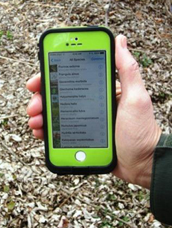
Statewide Eyes to allow volunteers and researchers alike to collect more information about invasive plants on state lands quickly. Volunteers (like you!) use a free mobile application called the Mid-Atlantic Early Detection Network (MAEDN) to identify, photograph and map the location of invasive plants, focusing on ecologically significant sites.
 The data are sent to the Early Detection and Distribution Mapping System or EDDMapS, a nationwide mapping system, to be freely displayed and available for download and analysis. The information gathered allows Department of Natural Resources scientists to:
- Analyze the greatest invasive plant threats on state land to plan and implement effective, efficient control efforts;
- Identify newly emerging invasive plants before their populations increase beyond our capacity to control them;
- Provide up-to-date information to the state
Invasive Plant Advisory Committee, which assesses plants to be listed as prohibited for sale which removes them from commercial trade in Maryland (Click here for the list of
Prohibited Species)
- Cooperate with partners in Maryland and across the region to identify, understand and address comprehensive invasion situations, such as the location of the “invasion front” of a species.
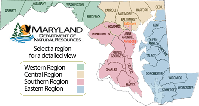
Invasive Species by Region
Here are the invasive plant species of greatest concern by region:
How does MAEDN work with EDDMapS?
The Mid-Atlantic Early Detection Network is a vast network of land managers, field experts, community scientists, naturalists, gardeners and others interested in documenting invasive plant occurrences in the mid-Atlantic region for the purposes of early detection, improved management and better coordination. The region includes Delaware, Maryland, New Jersey, New York, Pennsylvania, Virginia, West Virginia and the District of Columbia.
Early Detection and Distribution Mapping System (EDDMapS) is a web-based mapping system for documenting invasive species distribution. Launched in 2005 by the Center for Invasive Species and Ecosystem Health at the University of Georgia, it was originally designed as a tool for state Exotic Pest Plant Councils to develop more complete distribution data of invasive species.
Over 2.8 million records are logged on EDDMapS. For more information, see:
https://www.eddmaps.org/
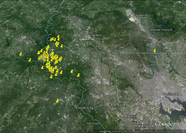
Here is a sample map from EDDMapS of wavyleaf basketgrass (Oplismenus undulatifolius) infestations outside Baltimore: