What is the Marcellus Shale and Where is it Located?
Marcellus Shale is the name given to the sedimentary rock formation that runs in the Appalachian Mountain region from eastern Tennessee to central New York State. Formed nearly 350 million years ago in the shallow sea that eventually became the Appalachian Mountains, this region is now a focus point for domestic energy production due to the large quantity of natural gas trapped in this organic-rich shale. In Maryland, the Marcellus Shale Region clips the western edge of the State, where gas exploration is confined to Garrett and western Allegany Counties.
 See map here for more information.
Why is there an Interest Now in Natural Gas Production from the Marcellus Shale?
The extraction of natural gas from this low permeability, deep shale formation has become commercially feasible due to the recent combination and application of relatively new technologies, including horizontal directional drilling, high volume slickwater hydraulic fracturing, and multi-well pads. Horizontal drilling involves a drill being sent down vertically a specific distance and then slowly turned ninety degrees horizontally into the shale formation. Hydraulic fracturing (fracking) is utilized to connect or create flowpaths for natural gas to escape the formation. Fracking involves the introduction of large volumes of fracture fluid containing water, proppant (usually sand) and chemical additives into the shale under extreme pressure to create vertical fractures in the shale layer. The proppant keeps the fractures/pathways open in the Marcellus Shale allowing for the recovery of natural gas. A multi-well pad is created when energy companies drill multiple gas wells on a single well pad. Clustering the wells on a single pad reduces the amount of infrastructure needed (e.g., pipelines can be shared) and the time period required for industrial activity is shortened because wells can be drilled in succession.
For more information on multi-well pads, see here.
What are Some Stream-Related Concerns Related to Hydrofracking?
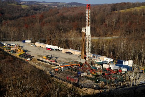
 An example of a hydrofracking rig.
Marcellus Shale natural gas development is a heavy industrial process that can be detrimental to stream and river health. Documented impacts to surface waters from shale gas development include stormwater runoff from well pads, roads, and other infrastructure including pipelines and gatherlines. Runoff can introduce sediment and toxic chemicals to streams and rivers causing adverse environmental impacts to biological communities. Hydraulic fracturing requires a large quantity of fresh water that is often withdrawn from surface waters. If not properly managed, streams and rivers could have a significant amounts of water removed that may reduce flows to critical levels, putting habitat for fish and other aquatic organisms at risk. Fracture fluid not only contains water and sand, but a variety of chemical additives. After hydraulic fracturing occurs, a portion of this solution comes back up the well and is referred to as flowback.
Flowback water can contain organics, salts, heavy metals, radionucleides, and other contaminants, including some undisclosed chemical additives introduced by the fracture fluid. This wastewater (i.e., flowback) does not pose harm to streams and rivers if it is handled properly. However, impacts to surface waters from flowback water have been documented in other states due to accidents, leaking holding ponds or tanks and intentional discharges. No matter what the cause, the release of flowback water into streams will adversely affect stream health.
What are Department Staff Doing to Ensure the Health of our Streams in Western Maryland?
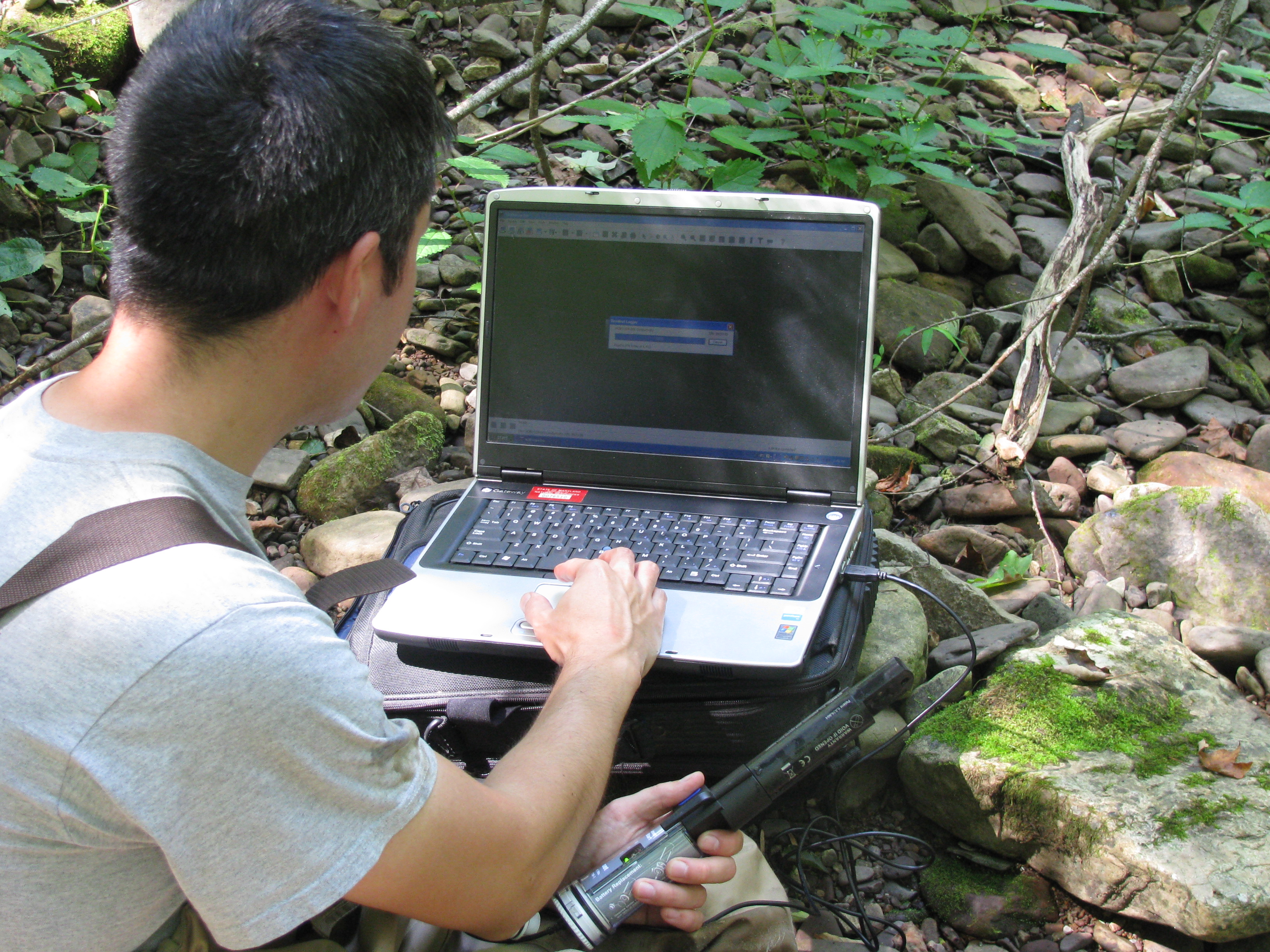
 Department biologist downloading data
from a conductivity logger.
In June 2011, department staff initiated monitoring efforts in Garrett County to determine baseline (range of values/health) conditions in select streams and rivers in advance of Marcellus Shale Natural gas development. The Department of Natural Resources is currently monitoring 12 streams in Garrett County, eight of which are located in the Youghiogheny River basin, associated with Marcellus Shale natural gas interests. Information collected from these streams includes continuous conductivity and temperature data, overall stream health based on the biological communities (fish and benthic macroinvertebrates), physical habitat, and a suite of water quality parameters.
Working with watershed associations, Trout Unlimited, colleges and other citizens in western Maryland, the department organized the Marcellus Shale Stream Monitoring Coalition (MMC) in March 2012 (department sponsored a training at New Germany State Park on March 3). The primary goal of the Coalition is to collect water quality and biological data from streams and rivers in Garrett County to help characterize baseline stream conditions. The Coalition is critical as it will supplement the department’s current and future stream monitoring efforts/needs and enhance spatial coverage in the Marcellus Shale region. Currently there are 60 volunteers participating in this monitoring program where data are being collected from an additional 70 streams.
Although department staff and citizen volunteers are currently collecting data from 82 stream reaches, this amount of monitoring effort accounts for less than 15% of the total number of stream reaches in Garrett County that could be affected by Marcellus Shale natural gas development. Furthermore, only a portion of the data needed for a comprehensive baseline characterization are being collected from these streams. Although important, the current monitoring effort is inadequate to establish comprehensive baseline stream conditions across Garrett County. Additional funding will be needed to accomplish this goal.
Some Helpful Links to Learn More
MDE information from mining program:
https://mde.state.md.us/programs/LAND/mining/marcellus/Pages/FactSheets.aspx
MGS information (our sister division):
http://www.mgs.md.gov/geology/minerals_energy_resources/marcellus.html