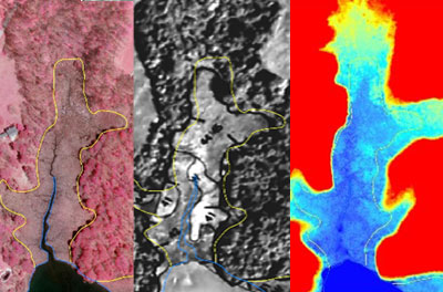
As the mapping update project progresses, the draft updated maps are being made available to the public, so that additional review and comment on the maps can take place. The draft maps and related supporting documentation are being presented at public information meetings, so that citizens and property owners can gain a better understanding of the process and see if their property is affected. State and local government staff are available at the public information meetings to talk directly with property owners.
Following the public information meetings, any areas requiring further review and analysis will be addressed, and necessary corrections will be made. The revised draft maps will then be formally transmitted from the Department of Natural Resources to the jurisdiction, and the Critical Area Commission will notify the jurisdiction that the mapping update project is complete as specified in the mapping legislation. The local government will then have 24 months to notify the public, and as appropriate to its legislative process, formally amend its program by adopting the Statewide Base Map with the shoreline and landward boundary of tidal wetlands, the digitally generated and geo-referenced 1,000-foot Critical Area boundary, and all applicable Critical Area designations.