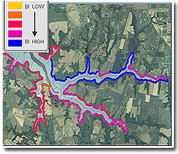
The Blue Infrastructure (BI) Near-shore Assessment is a detailed spatial evaluation of coastal habitat, critical natural resources and associated human uses in the tidal waters and near-shore area of Maryland’s coastal zone. The near-shore assessment serves as a link between Maryland’s terrestrial and aquatic environments and contributes to prioritization systems that help target conservation and management activities to maintain and improve coastal habitats. It is designed to incorporate estuarine priorities into targeting and land use planning and to complement the Green Infrastructure (GI) network. Several coastal and watershed features are considered in the Blue Infrastructure near-shore assessment:
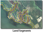
Terrestrial near-shore

The terrestrial shoreline is divided into unique 1 kilometer x 100 meter segments and assessed for land-cover characteristics; certain classes confer greater benefits than others in terms of buffering capacity, provision of habitat, and maintenance of natural processes. In addition, these segments are assessed for tidal wetland cores, sensitive and shoreline-dependent species, sandy beaches, point-source discharge and shoreline stabilization features.
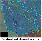
Watershed characteristics

12-digit coastal watersheds are assessed for undeveloped, protected and Green Infrastructure lands, as well as for levels of impervious surface. Particularly for many finfish species, levels of impervious surface are important indicators. Once the watersheds are assessed for these characteristics, all shoreline reaches within the watershed are assigned watershed baseline values that provide information about the conditions of their unique watershed.
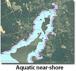
Aquatic near-shore

Each terrestrial near-shore segment is associated with a corresponding aquatic segment that reaches out to a depth of 2 meter. The aquatic segments are assessed for resources such as oyster bars, SAV beds, other shellfish, access structures, sandy bottom and fish spawning and nursery areas.
The values from the terrestrial, aquatic and watershed values are combined and result in a final near-shore BI rank. We invite you to use the Coastal Atlas’ Estuaries mapping tool to analyze and explore the data resulting from the Blue Infrastructure Near-shore Assessment and other useful aquatic resources data for the Chesapeake and Atlantic Coastal Bays.
Applications
The Chesapeake and Coastal Program is working to incorporate this assessment into:
- Environmental review processes to assess projects for aquatic, near-shore habitats, critical natural resources and associated human uses;
- Land conservation and management review and decision-making processes;
- A comprehensive conservation priority message to convey state-wide conservation targets to project partners and stakeholders.