 Monie Bay is a large and relatively undisturbed region which provides excellent habitat for wildlife and numerous opportunities for extensive wetland research.
Tidal creeks (including Monie Creek, Little Monie Creek, and Little Creek) flow through the marsh and together constitute an estuary: a body of water where freshwater mixes with saltwater. The resulting marsh habitat is rich in natural resources which numerous animals and plants rely on for food and shelter.
Check out our Story Map to view the diverse efforts occurring in this area to promote coastal resilience.
Research
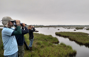
Due to its pristine conditions, Monie Bay is used for numerous research projects on marsh ecology conducted by CBNERR-MD. SET’s, or surface elevation tables, are used to monitor sediment accretion or erosion. In other words, they are used to measure if the marsh is growing or lowering. This is helpful in determining the resilience of the marsh, particularly in the context of climate change and sea-level rise. Other research conducted by staff and volunteers includes water quality monitoring, vegetative studies, and barn owl banding.
Monie Bay Water Trails
CBNERR-MD has recently built and opened the Monie Bay Water Trails to increase public access to this component and to educate visitors about Somerset County's ecological resources and maritime history.
Part of Monie Bay water trails are located within the Deal Island Wildlife Management Area, which provides public lands for hunting and fishing, as well as recreational activities such as wildlife viewing and hiking.
Each trail is equipped with signs indicating direction, trail color, and a number which correlates to a location reference on the trail map.
Monie Bay Water Trails include three trails of varying difficulty:
The Orange Trail:
This is an all-level, 2.7 mile round trip trail that follows Dames Quarter Creek only.
The Yellow Trail: This trail traverses Fanney's Gut. This is an all-level, 2.3 mile trail.
The White Trail: This is an intermediate to advanced trail for experienced paddlers. Round trip to Marsh Gut is 5.56 miles; round trip to Bay Point is 8.64 miles. Plan an all day trip.
The Monie Bay Water Trails Map
This map includes all three trails as well as information about local history, saltmarsh ecology, and flora and fauna that you may encounter on the trails.
All maps are provided in a pdf format that can be easily printed or viewed on a smart phone. Please click on the links below to access these maps.
